On May 18th, 1980, thirty years ago today, at 8:32 a.m., the ground shook beneath Mount St. Helens in Washington state as a magnitude 5.1 earthquake struck, setting off one of the largest landslides in recorded history - the entire north slope of the volcano slid away. As the land moved, it exposed the superheated core of the volcano setting off gigantic explosions and eruptions of steam, ash and rock debris. The blast was heard hundreds of miles away, the pressure wave flattened entire forests, the heat melted glaciers and set off destructive mudflows, and 57 people lost their lives. The erupting ash column shot up 80,000 feet into the atmosphere for over 10 hours, depositing ash across Eastern Washington and 10 other states. Collected here are photos of the volcano and its fateful 1980 eruption. [Editor's note: I lived in Eastern Washington at the time, and have strong memories of this event, the dark skies, the strangeness of it all. I can't believe it's been 30 years. -Alan] (37 photos totl)

2
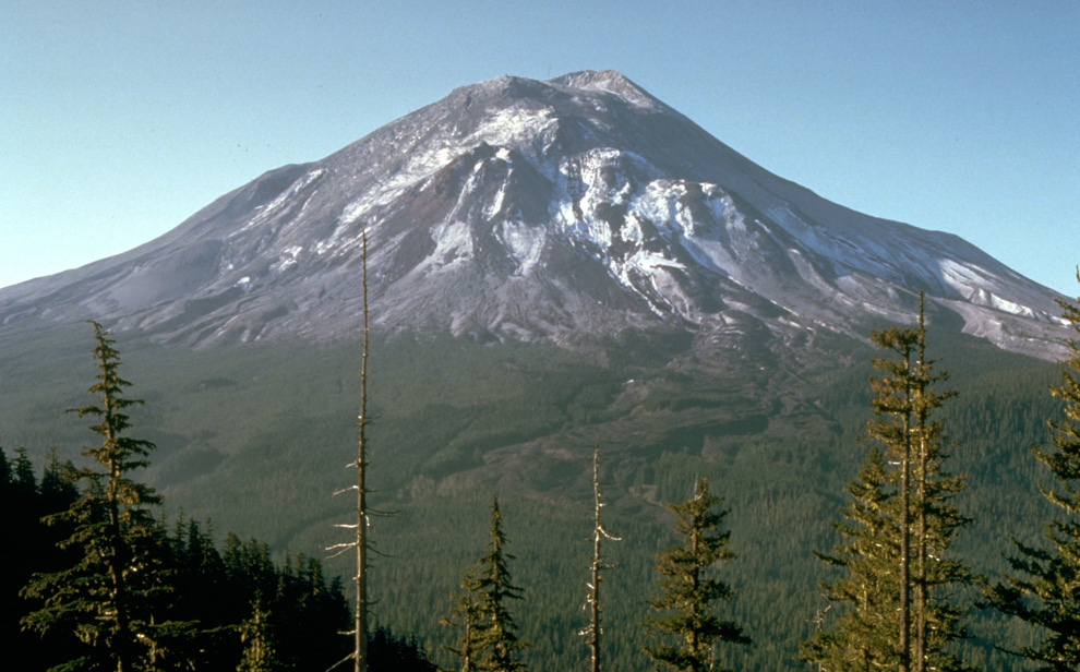
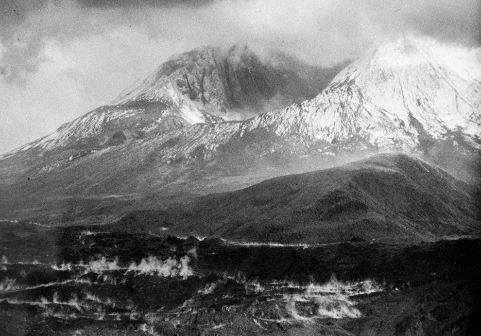
Mount St. Helens on the day before the eruption, May 17, 1980, as viewed from what came to be known as Johnston Ridge, about six miles from the volcano. (AP Photo/USGS, Harry Glicken)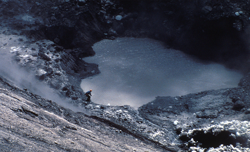
3
USGS vulcanologist Dave Johnston collects samples from Mount St. Helens crater lake on April 30, 1980. Two months of earthquakes and minor eruptions brought many observers and scientists to the volcano for study. (USGS/R.P. Hoblitt)
4
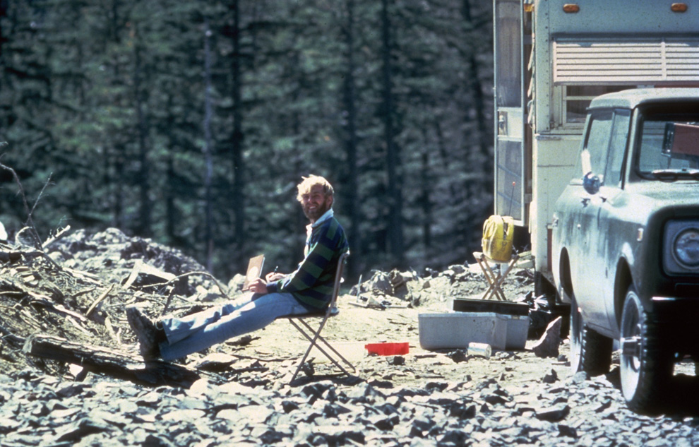
In this May 17, 1980 photo, 30-year old vulcanologist David Johnston is shown in the evening at his camp near what is now known as Johnston Ridge near Mount St. Helens. At 8:32 a.m. the next morning, Johnston radioed a message to the USGS headquarters: "Vancouver, Vancouver, this is it!", shortly before he was killed by the massive eruption of the volcano that also killed 56 others. (AP Photo/USGS Cascades Volcano Observatory, Harry Glicken)

5
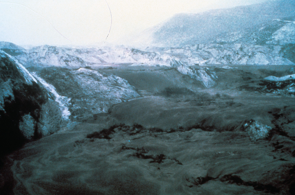
Mount St. Helens in eruption on May 18, 1980 showing the violence of the eruption in contrast with the apparently quiet countryside, Mount Adams in background, right. (USGS photo)

7
Thick hot mudflows begin to move downstream from the blast material deposited in the North Fork Toutle River valley downslope from erupting Mount St. Helens on May 18, 1980. This mudflow took nine hours to build in size sufficient to reach through the blasted material and move downstream to the Cowlitz River valley. The mudflow on the South Fork Toutle River arrived at Castle Rock, Washington, about 45 miles from the volcano, three hours after the eruption. (Harry Glicken)
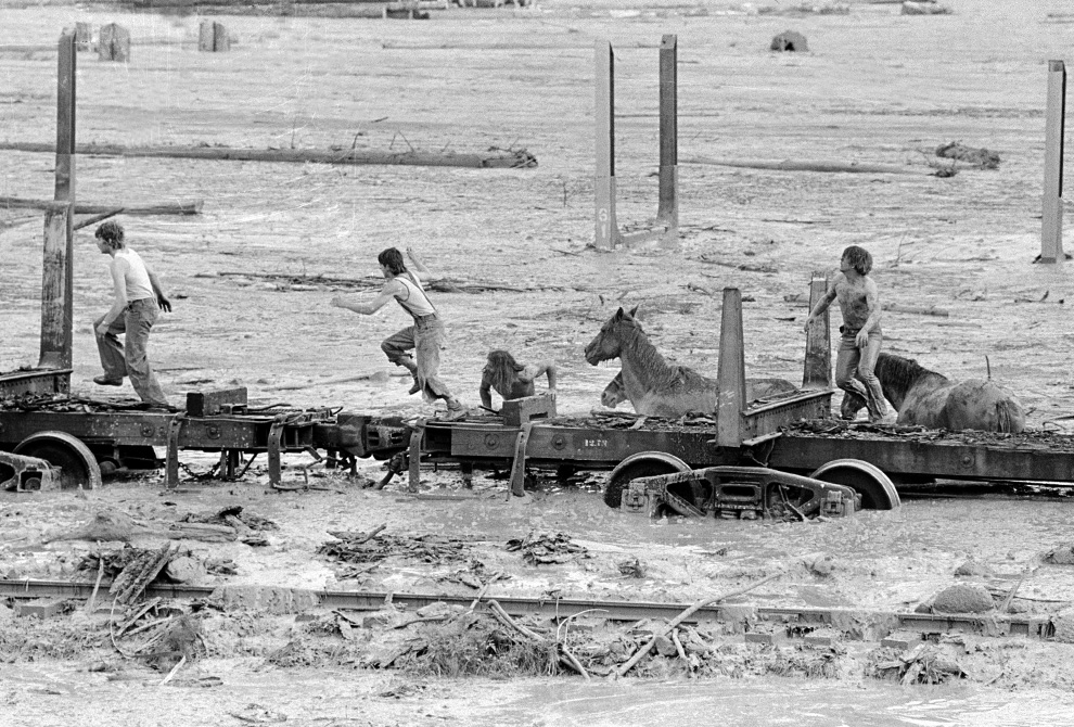
8
Bob Brown (right), John Brown and two other unidentified people are shown May 19, 1980 climbing onto a railroad car and heading down the train. The would-be horse rescuers gave up their efforts as they fled for their lives as flood waters from the Toutle River begin a sudden rise. All four people reached safety but the horses were presumed to have drowned. (AP Photo/Gary Stewart)
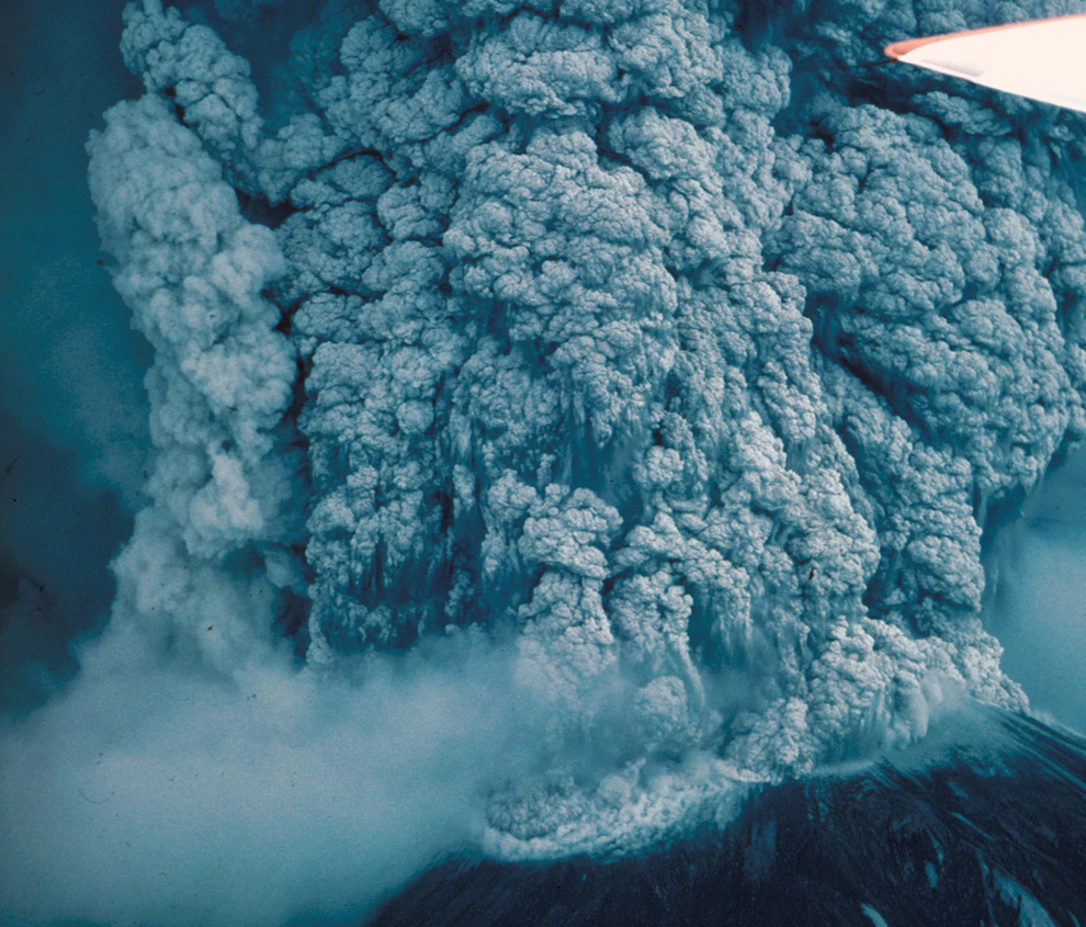
9
Mount St. Helens in eruption. Aerial view of upper part of volcano and the eruptive column on MAy 18th, 1980. (USGS photo) 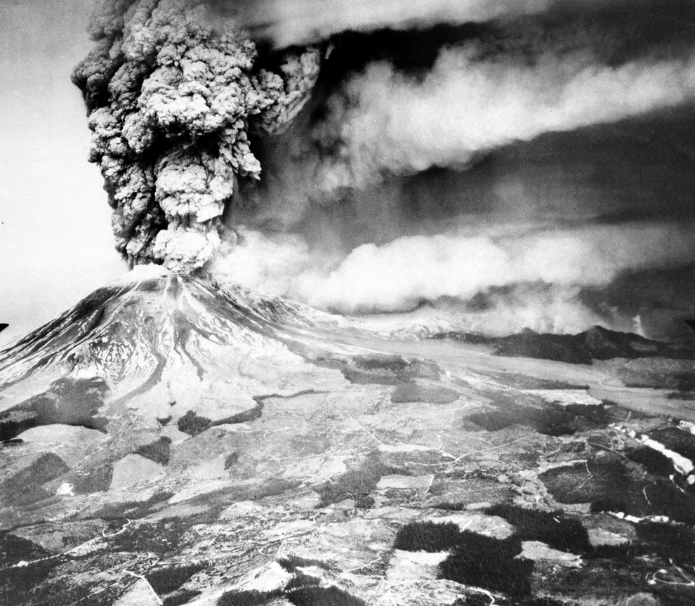
10
Mount St. Helens sends a plume of ash, smoke and debris skyward in this May 18, 1980 photo. The ash plume is being carried eastward by prevailing winds, depositing ash across several states. (AP Photo/US Geological Survey)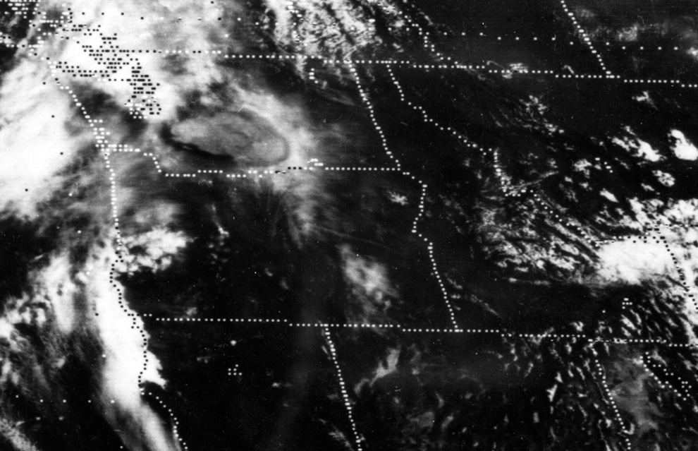
11
A satellite image shows the eastward spread of the ash plume across Washington state from the May 18th, 1980 eruption of Mount St. Helens, approximately one hour after the initial eruption. (NOAA)

12
Ashen clouds from the Mount St. Helens volcano move over Ephrata airport in Washington on Monday, May 19, 1980. (AP Photo/Mike Cash) 
13
A car is shown submerged in ash in this May 20, 1980 photo from Mount St. Helens eruption in Washington State. (AP Photo)
14
This aerial view shown May 23, 1980 from a search and rescue helicopter shows the new crater on Mount St. Helens formed by Sunday's massive eruption. Scientists described St. Helens' new horseshoe-shaped crater as about 5,000 feet deep and about 2 1/2 miles wide north to south on the north side of the mountain. (AP Photo/Gary Stewart)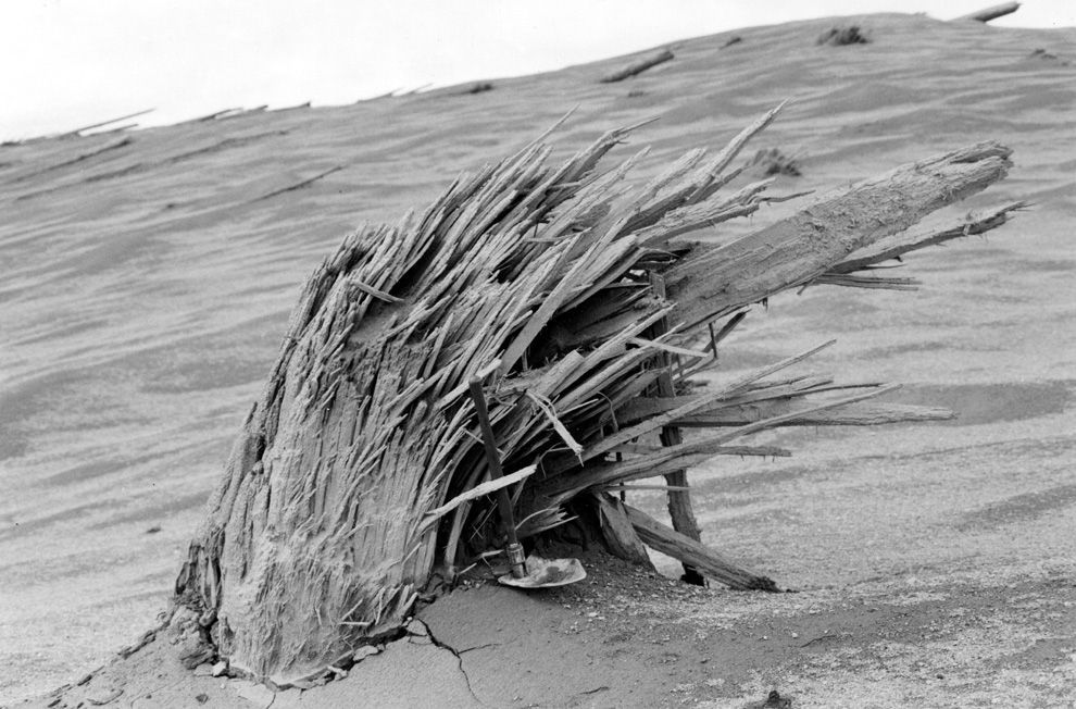
15
A splintered stump is all that remains of a tree that had grown on a now-desolate ridge near the North Fork Toutle River near Mount St. Helens. (USGS/S.W. Kieffer)
16
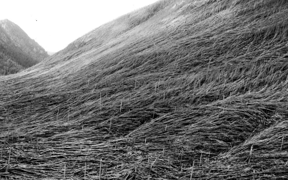
Massive blowdown of trees in the Green River valley seen on June 2, 1980. The flattening of the forest resulted from the May 18 eruption of Mount St. Helens. (USGS/J. DeVine)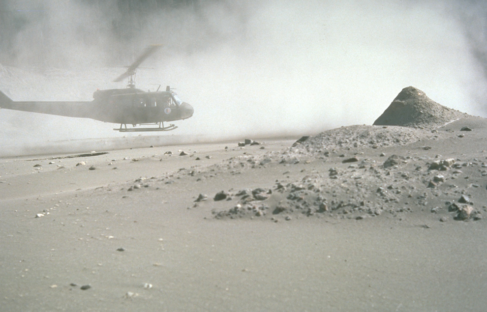
17
For weeks volcanic ash covered the landscape around the volcano and for several hundred miles downwind to the east. In this photograph, a helicopter stirs up ash while trying to land in the devastated area on August 22nd, 1980. (USGS/Lyn Topinka)
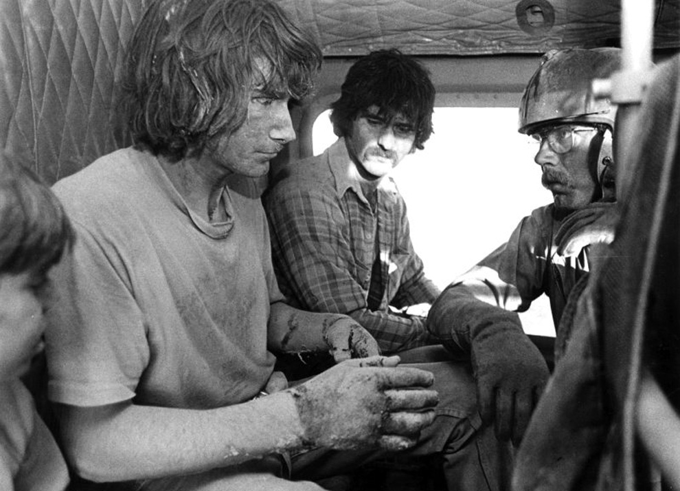
18
Army National Guard helicopter pilot Harold Kolb rescues two men and their sons from the devastated area around Mount St. Helens. One man's hands had been burned from his tent melting around him. (Washington National Guard) 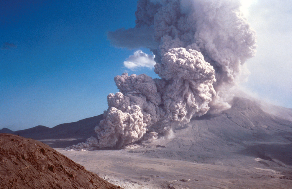

20
The melted Dashboard of pickup truck located on ridge top about 14 km north of Mount St. Helens demonstrates the powerful heat generated by the volcanic blast. Photo taken on June 18, 1980. (USGS photo)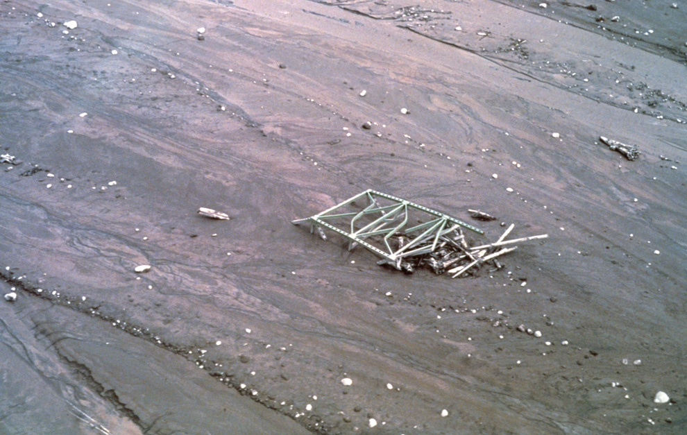
21
An aerial view of a bridge in the North Fork Toutle River valley that had been battered by logs and rocks, then partially buried in a massive mudflow. (USGS photo)
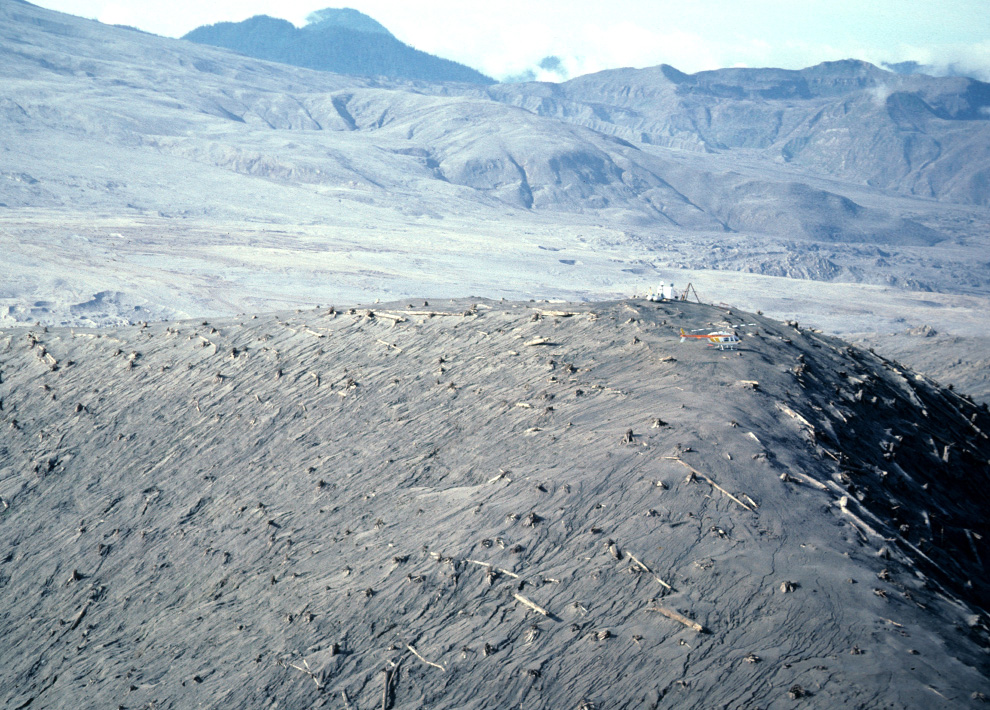
22
A helicopter rests near measuring instruments on Harrys Ridge on September 30, 1980, five miles north of Mount St. Helens' crater. (USGS/Lyn Topinka) 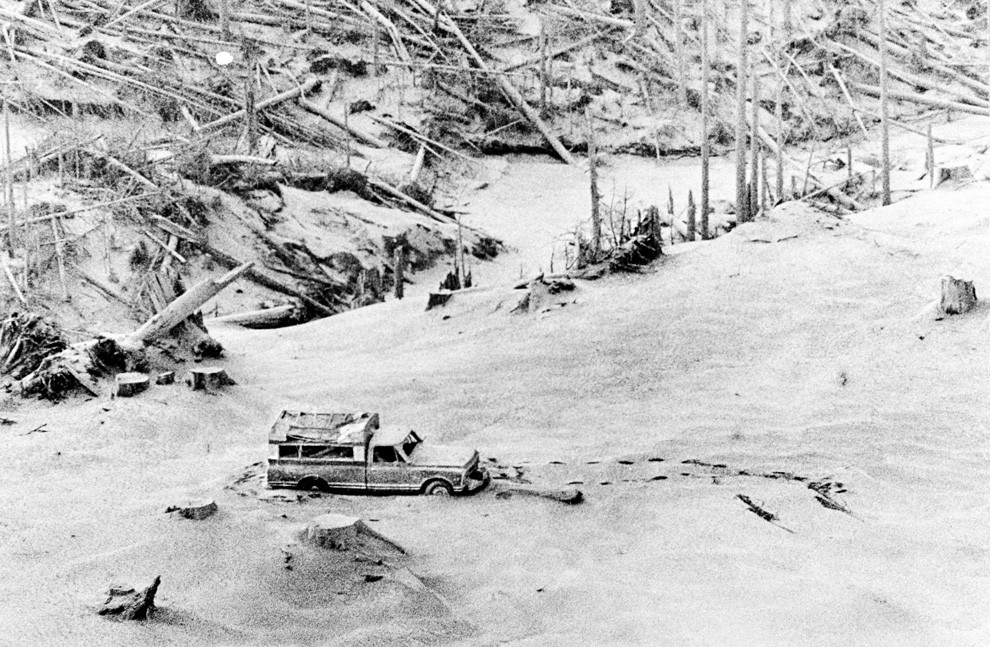
23
A camper containing two victims of the Mount St. Helens eruption sits amidst the gray landscape about 8 miles from the mountain. Marks in the volcanic ash in front of and behind the camper were left by a helicopter and a seacher who found the victims on Tuesday, May 20, 1980. (AP Photo)
24
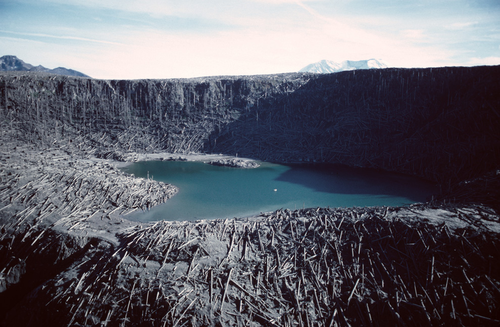
An aerial view of blowdown and Fawn Lake, inside the blast zone on October 28, 1980 (note Mount St. Helens in the background). Note also the USGS scientists in a small boat in the middle of the lake taking water samples. (USGS/Lyn Topinka) 
25
Blowdown wraps around a hillside, showing how the lateral blast of the eruption followed the countours of the landscape, seen on August 22, 1980 near the North Fork Toutle River. (USGS/Lyn Topinka)

26
A mudflow deposit covers Washington State Highway 504 near the town of Toutle, northwest of Mount St. Helens, to a depth of 2m (6 ft). Geologist for scale. (USGS/R.L. Schuster)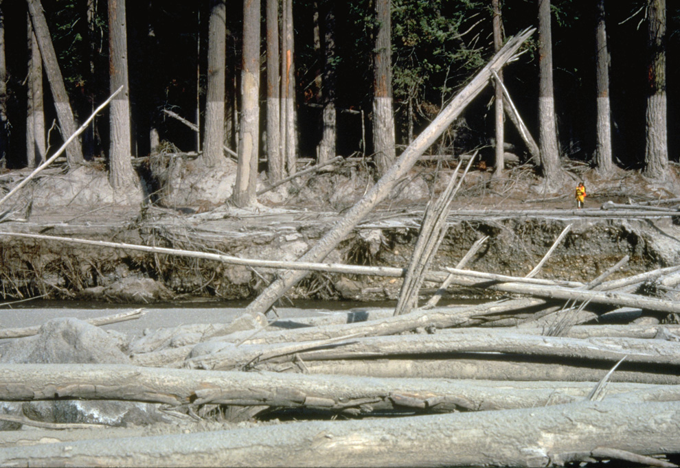
27
Nearly 135 miles (220 kilometers) of river channels surrounding the volcano were affected by the mudflows of May 18, 1980. A dirty line left behind on tree trunks shows the depth reached by the mud. A scientist (middle right) gives scale. This view is along the Muddy River, southeast of Mount St. Helens on October 23, 1980. (USGS/Lyn Topinka)
28
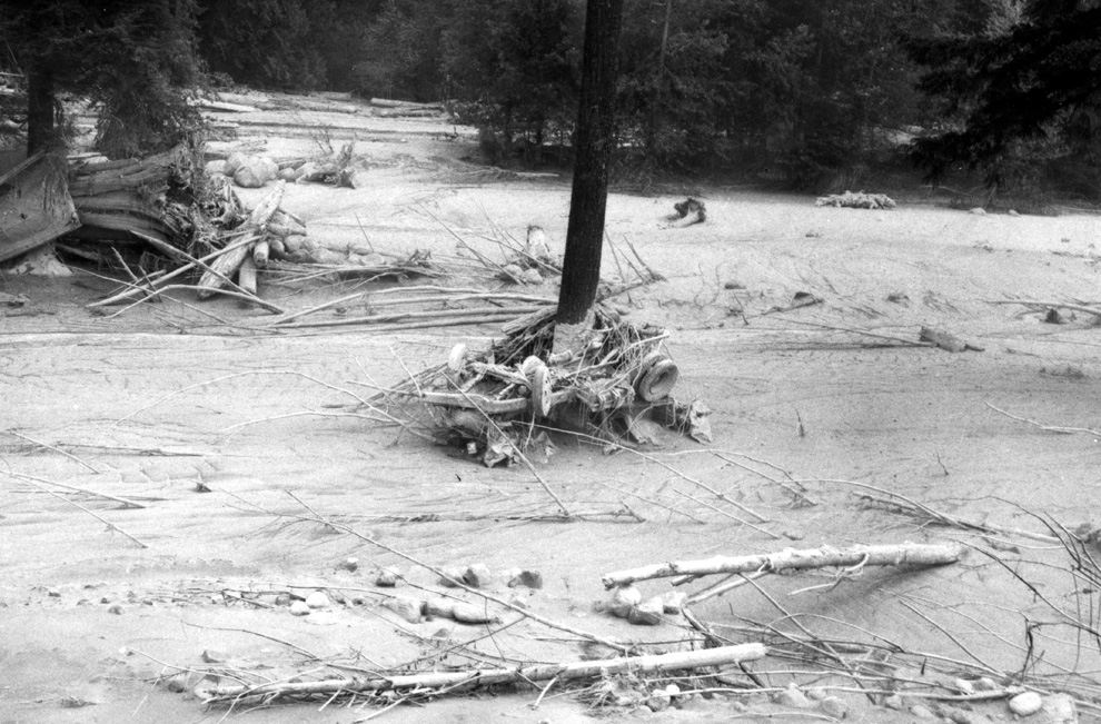
A vehicle is seen wrapped around tree due to the force of the mudflow on the North Fork Toutle River on July 11, 1980, near Camp Baker, northwest of Mount St. Helens in Washington state. (USGS photo) 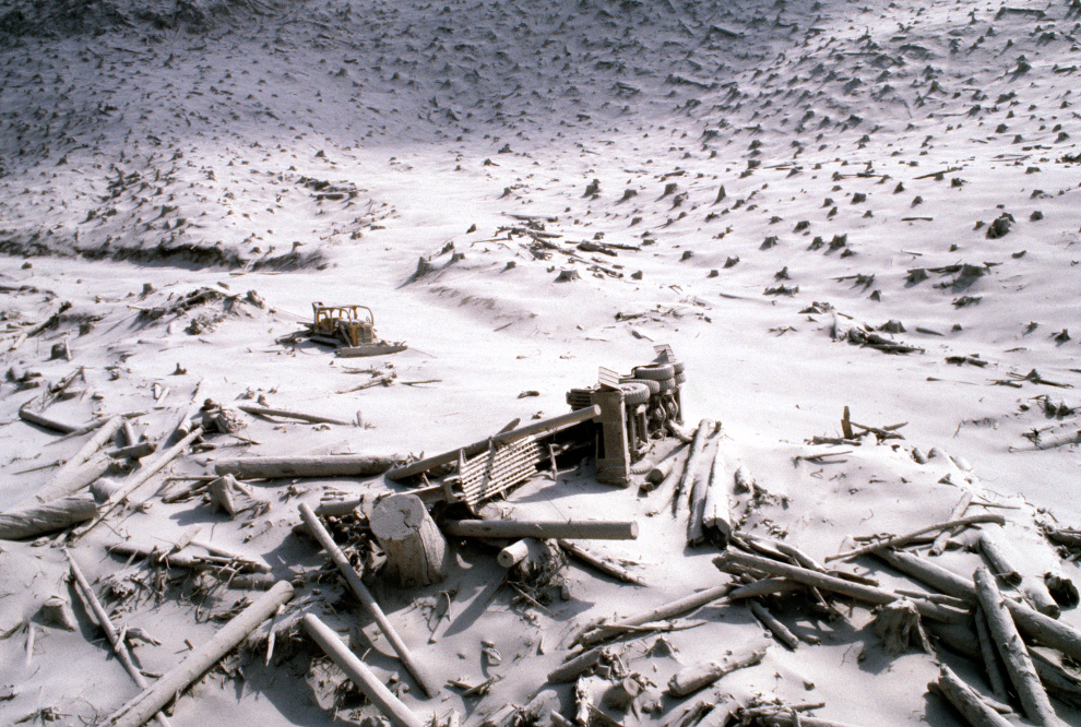
29
A wrecked logging truck and crawler tractor are shown amidst ash and downed trees near Mount St. Helens on May 20, 1980, two days after an explosive eruption. (AP Photo)

30
Thousands of trees in the North Fork Toutle River drainage area are shown blown down by the force of the May 18, 1980, eruption of Mount St. Helens, seen on Aug. 22, 1980. (AP Photo/USGS, Lyn Topinka) 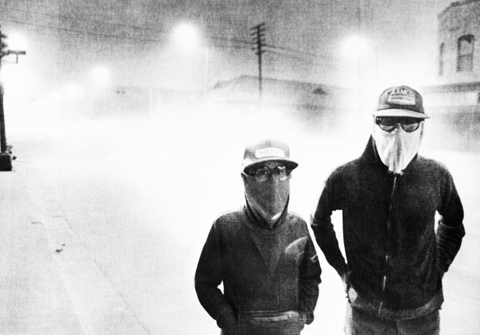
31
The streets of Yakima, Washington are dark at 3:00 PM after an eruption at Mount St. Helens on May 18, 1980. Light gray volcanic ash covered the streets and passersby wore masks to avoid breathing the ash. (AP Photo)
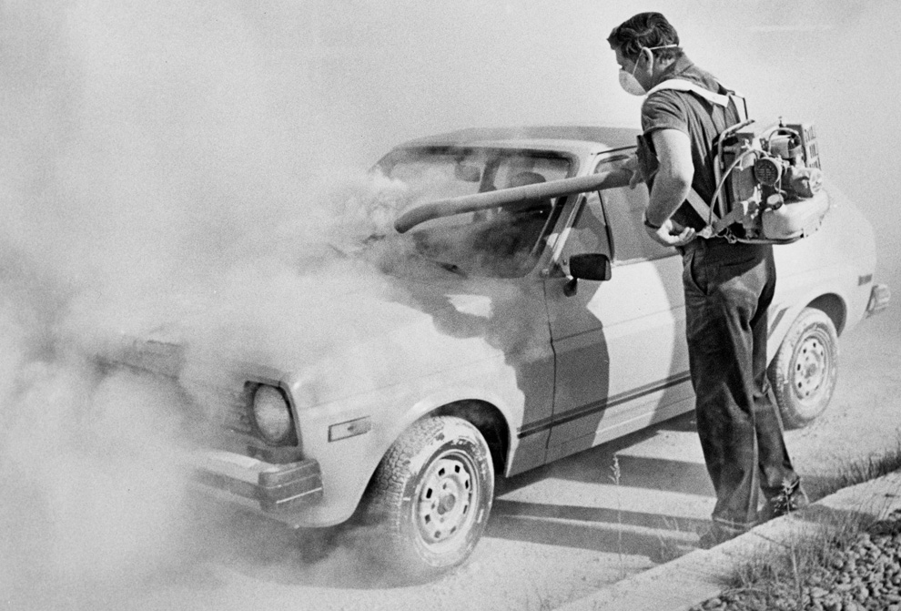
32
In this 1980 photo, a worker at an auto dealership in Moscow, Idaho used a blower to remove ash from the eruption of Mount St. Helens in Washington state, more than 350 miles away, from a car. (AP Photo/Moscow-Pullman Daily News)
33
On the slopes of Mount St. Helens, colorful ponds dot the debris avalanche, their chemical composition varying wildly and affecting the color of the water. Photo taken on August 8, 1981. (USGS/Lyn Topinka)
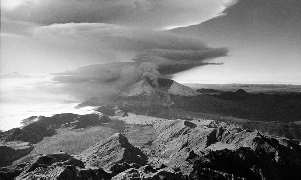
34
Mount St. Helens spews smoke and ash skyward as the volcano erupts once more on October 17th, 1980. (AP Photo/Jack Smith) 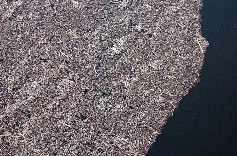
35
When Mount St. Helens erupted, the preceding gigantic landslide actually displaced all of the water in nearby Spirit Lake, which washed up hillsides, then splashed back down, dragging debris and fallen trees into its new lakebed. This March 29, 2007 photograph shows just a portion of the thousands of trees that remain floating in a giant raft on the surface of the lake to this day. (USGS/Cindy Werner)

'Someting Good' 카테고리의 다른 글
| Checking in on Saturn (0) | 2010.05.22 |
|---|---|
| Crackdown in Bangkok (1) | 2010.05.20 |
| Protests turn deadly in Thailand (0) | 2010.05.18 |
| First of the last Space Shuttle launches (0) | 2010.05.15 |
| Disaster unfolds slowly in the Gulf of Mexico (1) | 2010.05.14 |


